
History of the Institution
Introduction
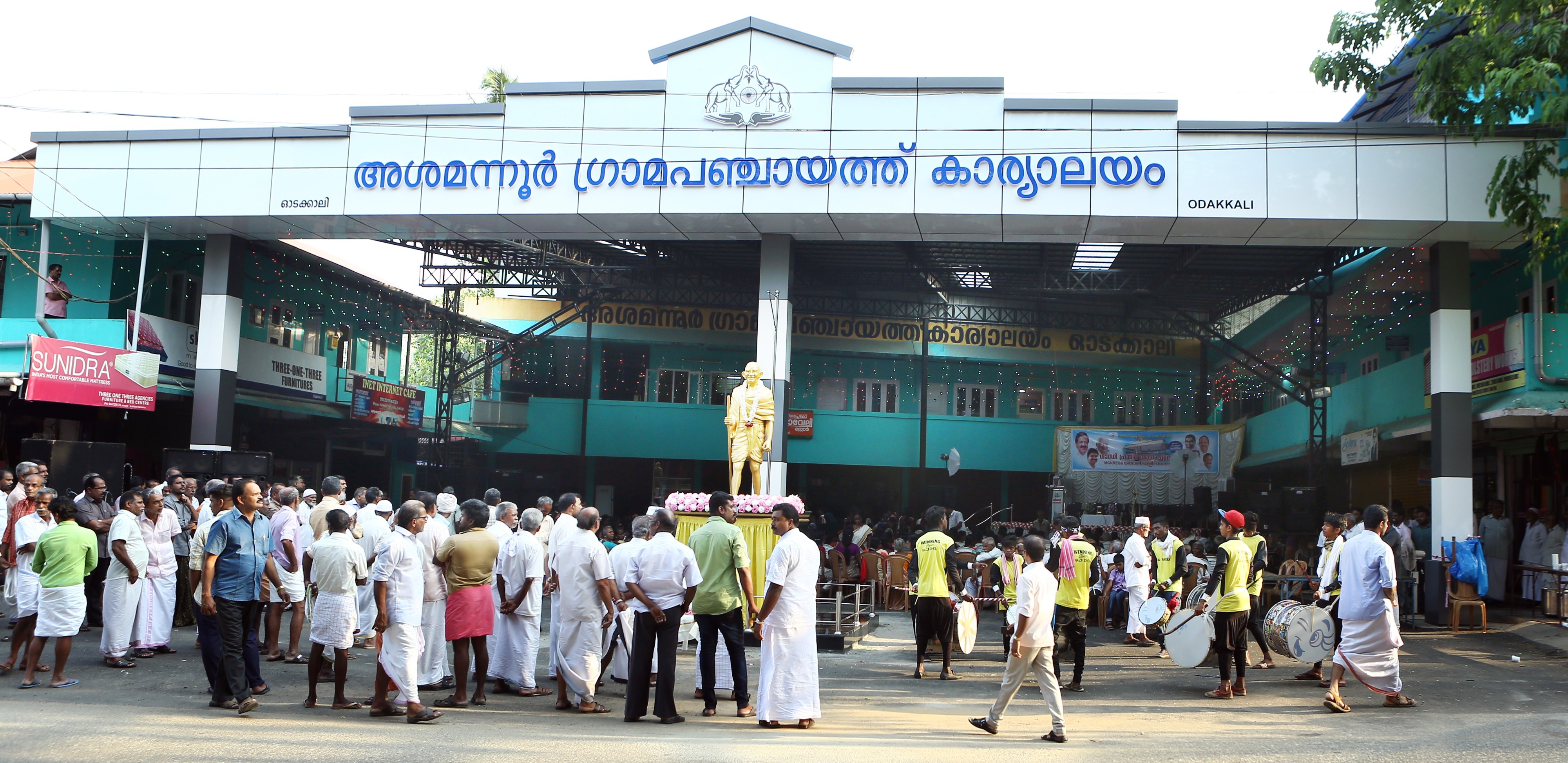
Asamannoor Grama Panchayat is a local self-government institution falling under the Asamannoor village jurisdiction in Kunnathunad taluk, Koovappady block, Ernakulam district. Spanning an area of 21.27 square kilometers, this governing region is bounded on the north by Vengoor, Kottoppady, Rayamangalam, and Mudakuzha panchayats; on the south by Paipra, Rayamangalam, and Nellikkuzhi panchayats; on the west by Rayamangalam panchayat; and on the east by Nellikkuzhi and Kottoppady panchayats. The major localities coming under the jurisdiction of this grama panchayat are Methala, Ekkunnam, Thalappuncha, Cherukunnam, Punniyam, Asamannoor, Payyal, Panichayam, Nooleli, and Odakkali.
Formation and Administrative History
Asamannoor Grama Panchayat officially came into existence in 1953. Initially, the governing body consisted of merely six wards and seven members. At that time, in addition to a general seat, ward 1 also included a reserved seat. The tenure of the first governing body was three years. Sri K. Kesavan Pisharody served as the first president of the panchayat, followed by Sri S.N. Nair.
From 1957 onward, the elected governing body was replaced, and administrator rule came into effect. Later, elections to the grama panchayat were held again in 1963. In addition to seven members, this governing body also included a women's representative nominated to the council. Smt. Bhanumathi Balakrishnan was that women's representative. This marked the first women's representation in the administrative sphere of Asamannoor Panchayat.
Panchayat Headquarters: Odakkali
The headquarters of Asamannoor Grama Panchayat is situated in 'Odakkali'. In the past, this was a secluded area filled with wild grass, which served as a haven for thieves and highway robbers. Elders of the locality testify that the present administrative nerve center derived the name 'Odakkali' from a Muslim merchant named 'Odakkal Ali', who used to carry on a lime (chuna) trade here.
Socio-Political Background
Historically, the present Asamannoor region was a part of the 'Vadakkumkoor' kingdom, which came into existence following the partition of Vempolinad around 1100 AD. Later, during the reign of Maharaja Marthanda Varma, it became a part of Travancore. Thus, this populace—having been subjects of Vadakkumkoor, then Travancore, and subsequently Thiru-Kochi—eventually became a part of Kerala.
Following independence, this panchayat served as one of the primary operational centers of peasant movements that emerged in Kerala. The majority of the people in the panchayat joined the state-wide struggles against feudalism, playing a decisive role in achieving the objective of 'land to the tiller'.
Topography and Cultural Heritage
The topography of this panchayat comprises Kodikuthiyani Malai—the highest point situated between the Periyar and Muvattupuzha rivers—along with more than 15 other hills and valleys. A major developmental milestone here is the Periyar Valley High Level Canal, which passes through a tunnel nearly a kilometer long beneath the Methala hills along the southern part of the panchayat.
This region also bears the deep imprint of the influence of Jain culture. The ancient 'Kallil Temple' in Methala, declared a government-protected historical monument in 1965, stands as a symbol of the grama panchayat's cultural heritage. The hill known as Kazhuvettummol, where capital punishments were executed in ancient times, also remains here as a remnant of history.
The social foundation of this panchayat was laid by an educated and visionary older generation. The unity and coexistence of Hindu, Muslim, and Christian communities have been the hallmark of this panchayat then and now. The presence of luminaries of national renown in the realm of arts—such as Kathakali exponent Chandramana Sreedharan Namboothiri, Darpana Govindan Namboothiri, and musician M.K. Sankaran Namboothiri—further enriches the cultural history of Asamannoor Grama Panchayat.